


| Поиск по каталогу |
|
(строгое соответствие)
|
- Профессиональная
- Научно-популярная
- Художественная
- Публицистика
- Детская
- Искусство
- Хобби, семья, дом
- Спорт
- Путеводители
- Блокноты, тетради, открытки
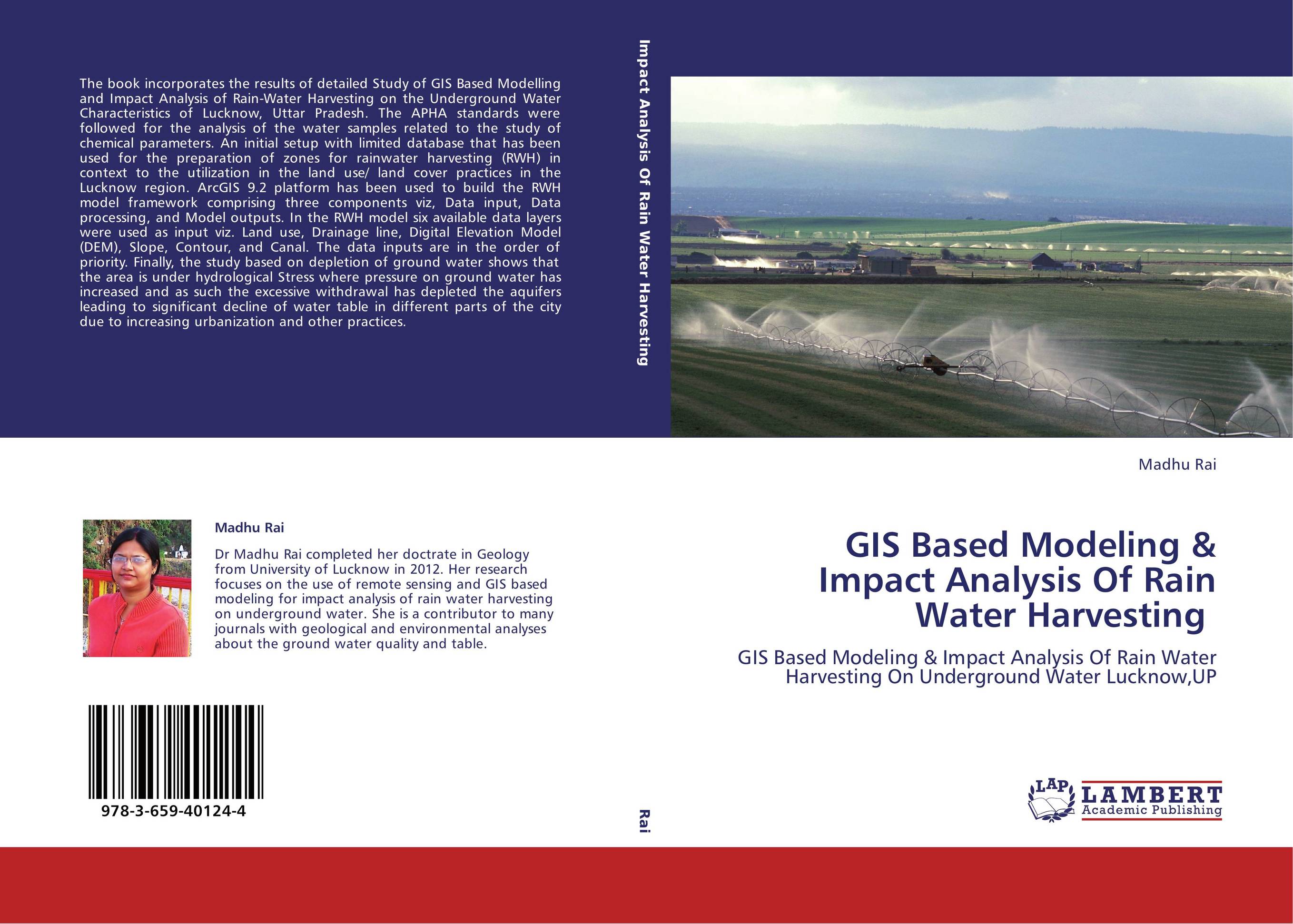
GIS Based Modeling & Impact Analysis Of Rain Water Harvesting. GIS Based Modeling & Impact Analysis Of Rain Water Harvesting On Underground Water Lucknow,UP
В наличии
| Местонахождение: Алматы | Состояние экземпляра: новый |

Бумажная
версия
версия
Автор: Madhu Rai
ISBN: 9783659401244
Год издания: 2013
Формат книги: 60×90/16 (145×215 мм)
Количество страниц: 196
Издательство: LAP LAMBERT Academic Publishing
Цена: 46721 тг
Положить в корзину
| Способы доставки в город Алматы * комплектация (срок до отгрузки) не более 2 рабочих дней |
| Самовывоз из города Алматы (пункты самовывоза партнёра CDEK) |
| Курьерская доставка CDEK из города Москва |
| Доставка Почтой России из города Москва |
Аннотация: The book incorporates the results of detailed Study of GIS Based Modelling and Impact Analysis of Rain-Water Harvesting on the Underground Water Characteristics of Lucknow, Uttar Pradesh. The APHA standards were followed for the analysis of the water samples related to the study of chemical parameters. An initial setup with limited database that has been used for the preparation of zones for rainwater harvesting (RWH) in context to the utilization in the land use/ land cover practices in the Lucknow region. ArcGIS 9.2 platform has been used to build the RWH model framework comprising three components viz, Data input, Data processing, and Model outputs. In the RWH model six available data layers were used as input viz. Land use, Drainage line, Digital Elevation Model (DEM), Slope, Contour, and Canal. The data inputs are in the order of priority. Finally, the study based on depletion of ground water shows that the area is under hydrological Stress where pressure on ground water has increased and as such the excessive withdrawal has depleted the aquifers leading to significant decline of water table in different parts of the city due to increasing urbanization and other practices.
Ключевые слова: GIS, Remote sensing, GROUND WATER HARVESTING