


| Поиск по каталогу |
|
(строгое соответствие)
|
- Профессиональная
- Научно-популярная
- Художественная
- Публицистика
- Детская
- Искусство
- Хобби, семья, дом
- Спорт
- Путеводители
- Блокноты, тетради, открытки
Satellite Remote Sensing for Planning New Urban Environment. Spatio-Temporal Analysis of Urban Ecology in Karachi, Pakistan by using Remote Sensing and Geographic Information System
В наличии
| Местонахождение: Алматы | Состояние экземпляра: новый |

Бумажная
версия
версия
Автор: Rida Batool
ISBN: 9786202680059
Год издания: 2020
Формат книги: 60×90/16 (145×215 мм)
Количество страниц: 108
Издательство: LAP LAMBERT Academic Publishing
Цена: 32173 тг
Положить в корзину
| Способы доставки в город Алматы * комплектация (срок до отгрузки) не более 2 рабочих дней |
| Самовывоз из города Алматы (пункты самовывоза партнёра CDEK) |
| Курьерская доставка CDEK из города Москва |
| Доставка Почтой России из города Москва |
Аннотация: Urbanization is a splendid perspective for the development in country and generates revenue in economy. Urban system has been increased due to population and has started exploiting ecosystems, they are now diversely driving nature from the semi-natural habitat to wastelands, parks human forced isotopes with their associated species. A new system of ecology has arose in urban areas named as 'urban ecology'. Main purpose of this study is to indicate the threats to natural environment of Karachi city. This research comes up with the temporal analysis of transition of urban ecology from year 2000 to 2016, Karachi is considered as the highest economy in Pakistan as it has sea port, industries, mills business center and fisheries but this race has compromised peace and health of city meanwhile, citizens have experienced climatic variation in last two decades. Satellite Remote Sensing (SRS) is the most inexpensive and effective means of extracting information and analyzing facts, moreover, SRS techniques provides high resolution images with multi-spectral data and useful information with a glimpse. Major findings of this study were followed by multiple algorithm analysis.
Ключевые слова: GIS, RS, Environment, climate, Ecology, urban, karachi, SRS
Похожие издания
 | Отрасли знаний: Точные науки -> Информатика и программирование Dr. Eng. Assaad El Makhloufi,Prof. Samir El Adib and Prof. Naoufal Raissouni FPGA Embedded Systems in Satellite Remote Sensing. AES LST-SW Algorithm. 1905 г., 192 стр., мягкий переплет On-board computed LST, as a solution, enables efficient reuse of expensive hardware resources, and data can be modified, processed and compressed, reducing the amount of data to be transferred. Additionally, it enables autonomous on-board decisions that can potentially reduce the time between image capture, analysis, and associated action.The... | 47257 тг |
 | Отрасли знаний: Науки о Земле Mukesh Singh Boori Satellite Remote Sensing for Earth and Space Science. Earth Observation & Geo-informatics. 1905 г., 412 стр., мягкий переплет This is a text or coursebook for bachelor and master level students in the field of remote sensing and geo-informatics. A researcher who belongs to earth and space science can also use this book. This book has six sections and offers a successive deeper understanding of RS / GIS / Geoinformatics. Section I introduce the most basic concepts of... | 64268 тг |
 | Отрасли знаний: Науки о Земле Oluwagbenga Aremu and Oluwagbenga Aremu Temporal Land Cover Change Detection. Landsat Earth Observation Satellite Remote Sensing. A Case Study of Schwedt/Oder Region. 2020 г., 104 стр., мягкий переплет The research contents were derived with the use of Fragmentation statistics, spatial analysis and remote sensing techniques. These techniques could be observed throughout the workflow used from the beginning till the very end of the research. The workflow simply expentiates on simple steps which could be carried out in the correction of... | 32031 тг |
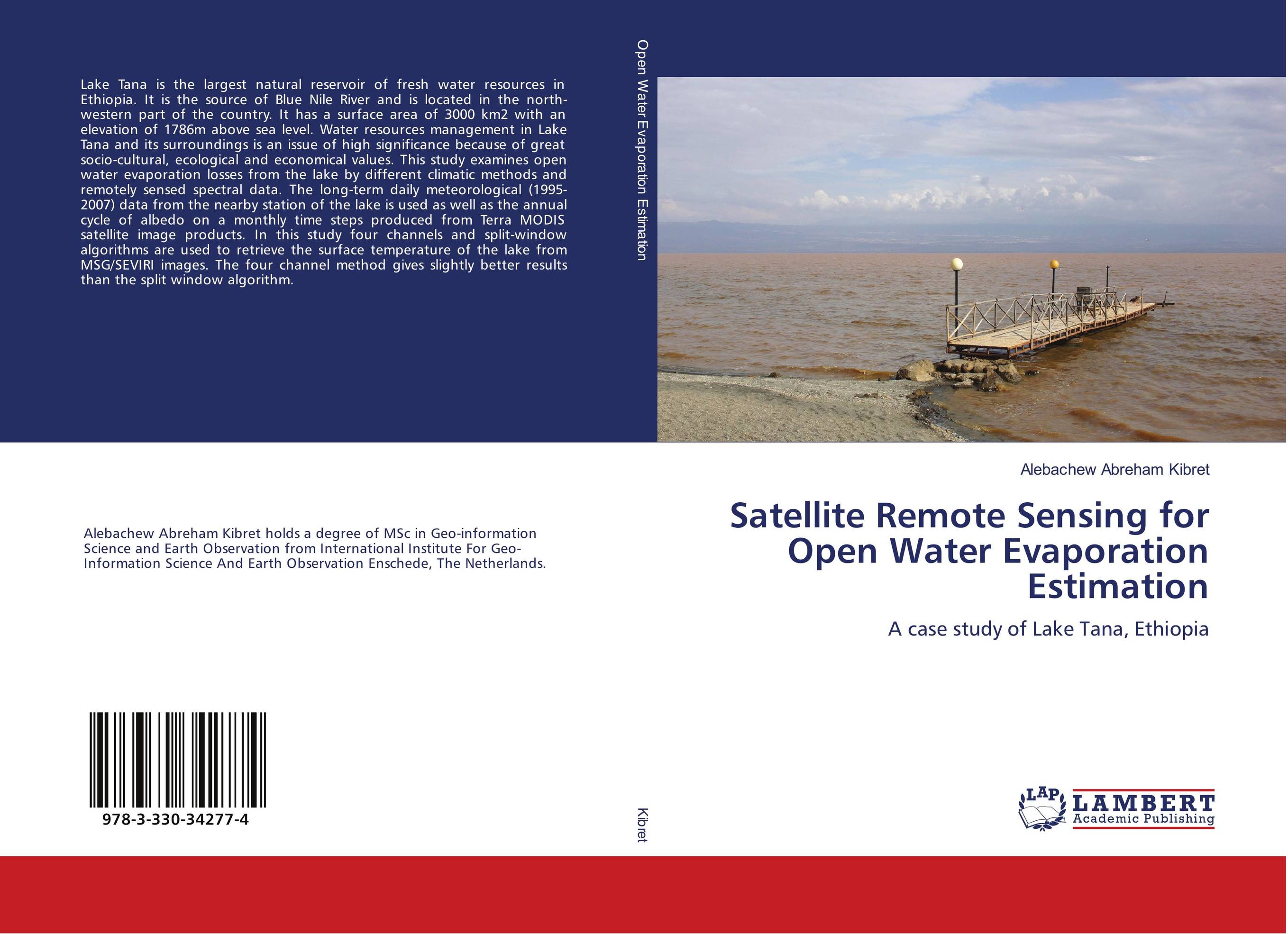 | Отрасли знаний: Точные науки -> Информатика и программирование Alebachew Abreham Kibret Satellite Remote Sensing for Open Water Evaporation Estimation. A case study of Lake Tana, Ethiopia. 2018 г., 116 стр., мягкий переплет Lake Tana is the largest natural reservoir of fresh water resources in Ethiopia. It is the source of Blue Nile River and is located in the north-western part of the country. It has a surface area of 3000 km2 with an elevation of 1786m above sea level. Water resources management in Lake Tana and its surroundings is an issue of high significance... | 32457 тг |
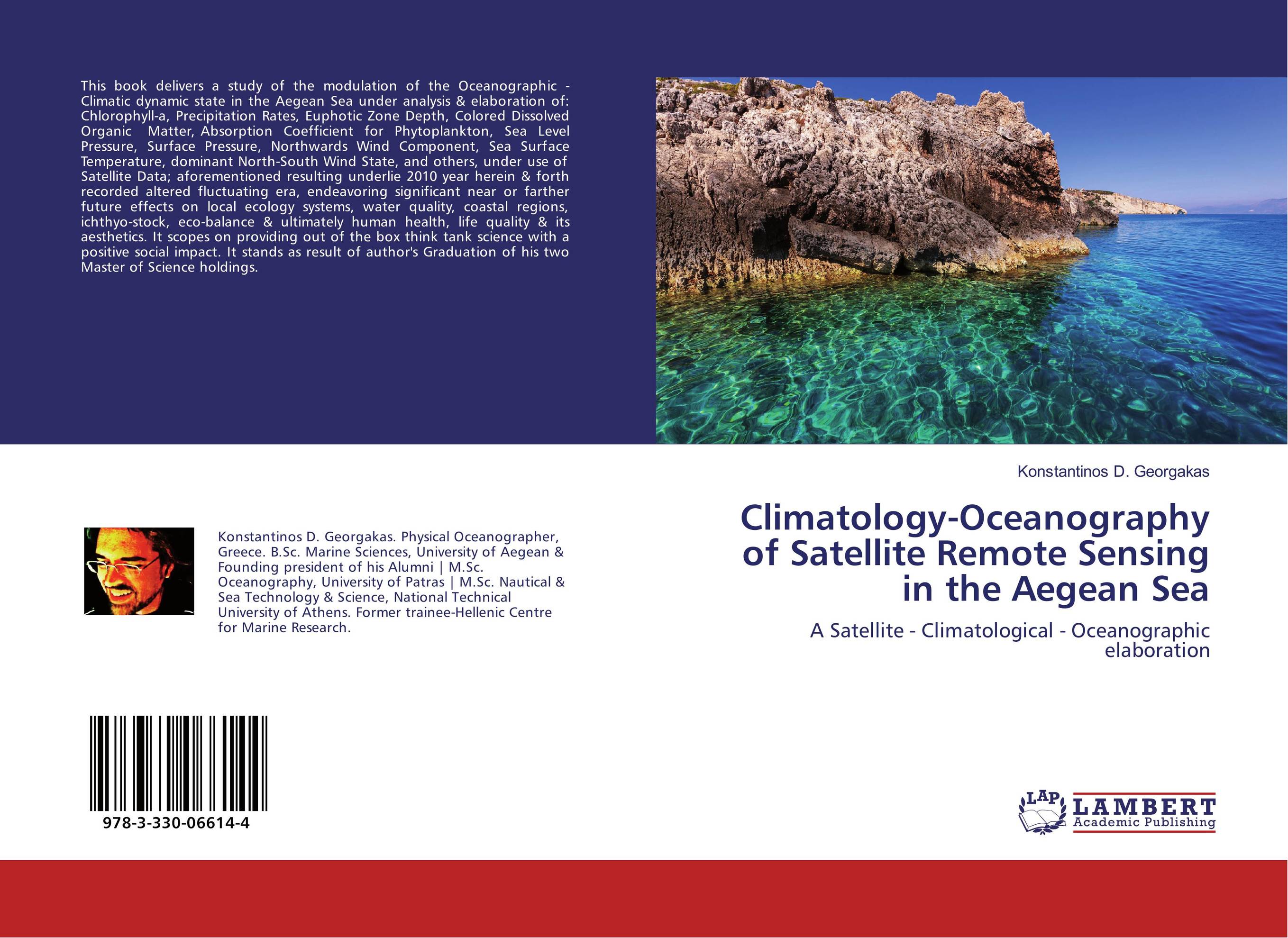 | Отрасли знаний: Наука в целом Konstantinos D. Georgakas Climatology-Oceanography of Satellite Remote Sensing in the Aegean Sea. A Satellite - Climatological - Oceanographic elaboration. 2017 г., 96 стр., мягкий переплет This book delivers a study of the modulation of the Oceanographic - Climatic dynamic state in the Aegean Sea under analysis & elaboration of: Chlorophyll-a, Precipitation Rates, Euphotic Zone Depth, Colored Dissolved Organic Matter, Absorption Coefficient for Phytoplankton, Sea Level Pressure, Surface Pressure, Northwards Wind Component, Sea... | 24487 тг |
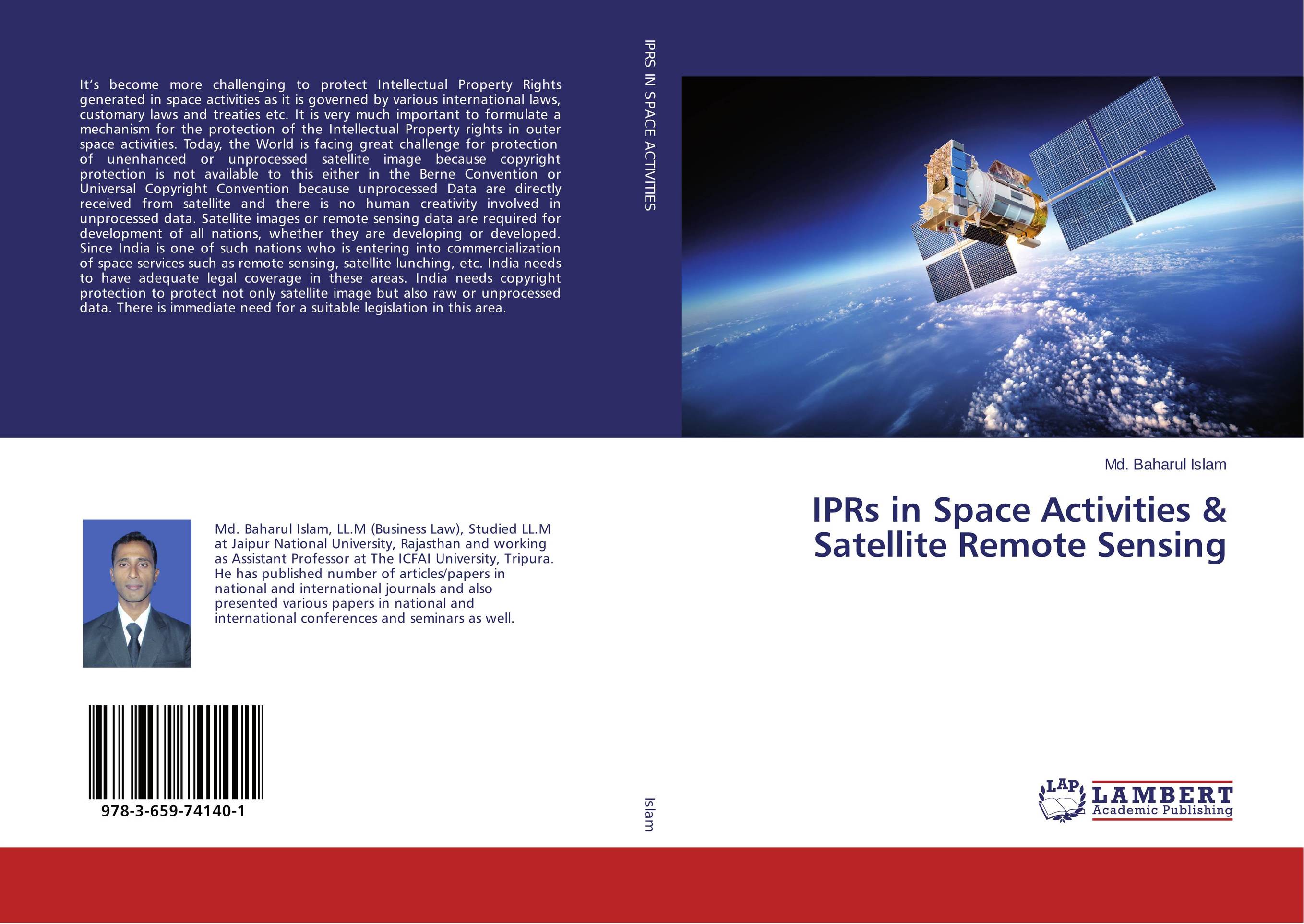 | Отрасли знаний: Общественные науки -> Юриспруденция Md. Baharul Islam IPRs in Space Activities & Satellite Remote Sensing. . 2015 г., 244 стр., мягкий переплет It’s become more challenging to protect Intellectual Property Rights generated in space activities as it is governed by various international laws, customary laws and treaties etc. It is very much important to formulate a mechanism for the protection of the Intellectual Property rights in outer space activities. Today, the World is facing great... | 47652 тг |
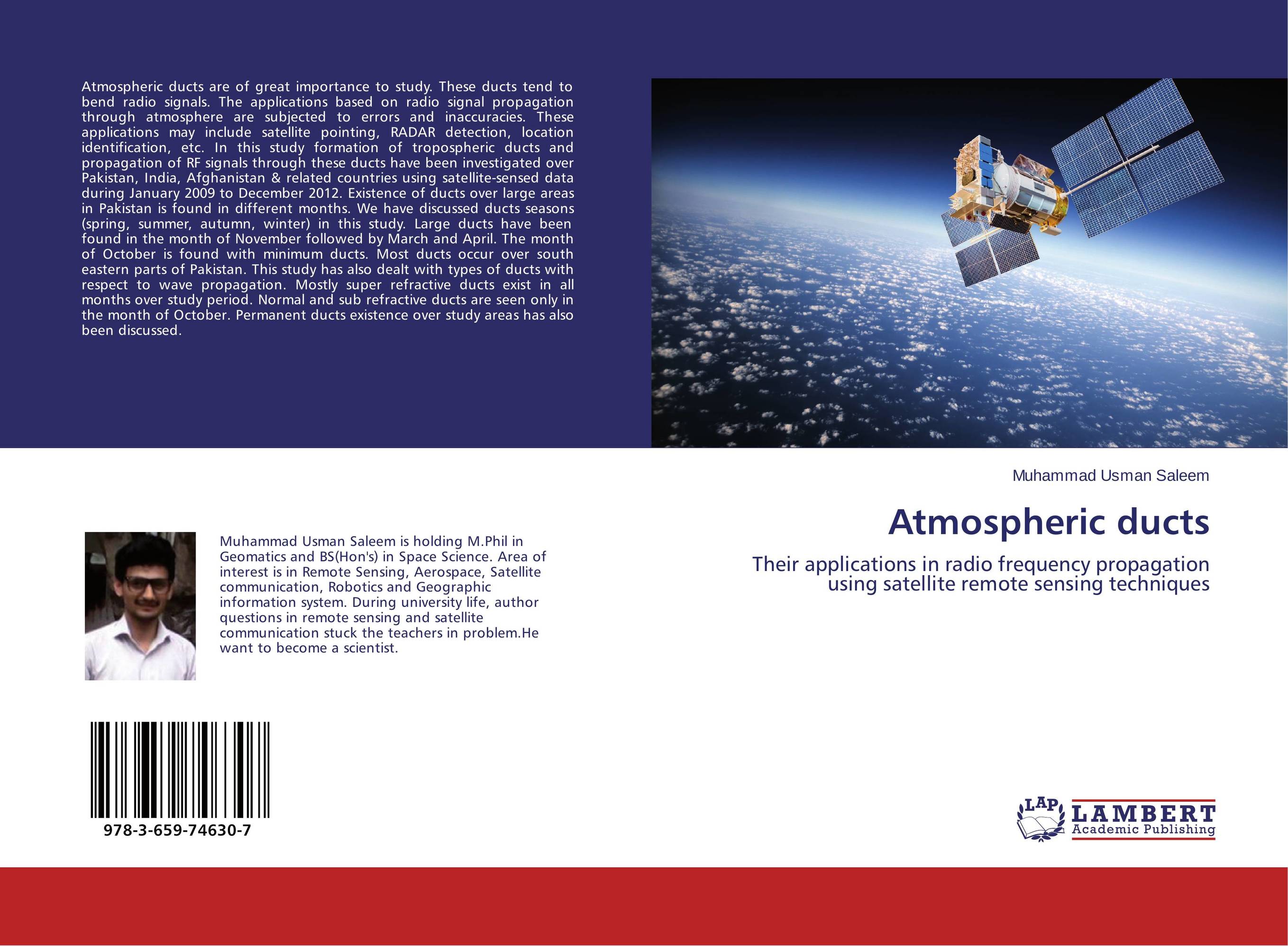 | Отрасли экономики: Приборостроение -> Производство электронных компонентов Muhammad Usman Saleem Atmospheric ducts. Their applications in radio frequency propagation using satellite remote sensing techniques. 2015 г., 56 стр., мягкий переплет Atmospheric ducts are of great importance to study. These ducts tend to bend radio signals. The applications based on radio signal propagation through atmosphere are subjected to errors and inaccuracies. These applications may include satellite pointing, RADAR detection, location identification, etc. In this study formation of tropospheric ducts... | 23066 тг |
 | Отрасли знаний: Естественные науки -> Экология D.D.G.L. Dahanayaka,Hideyuki Tonooka and Satoru Ozawa Satellite Remote Sensing for Environmental Assessment of Water Bodies. . 2013 г., 184 стр., мягкий переплет In these days, many Asian countries are rapidly developing according to their fast growing economies, which often cause considerable environmental changes around water bodies such as lakes, reservoirs and lagoons. Remote sensing technology can be integrated in long-term studies, both retrospective and predictive, in order to anticipate degradation... | 27129 тг |
 | Отрасли экономики: Агропромышленный комплекс -> Растениеводство -> Садоводство Mukti Zainuddin Prediction of Albacore Tuna Habitat Hot Spots. A Satellite Remote Sensing and GIS Perspective. 2013 г., 120 стр., мягкий переплет Ocean hot spots are key pelagic habitats for tuna. A better understanding of these biologically rich areas leads to one important step in better tuna management. The main scientific findings of this study are presentation methods on how to detect, identify and predict potential habitat hot spots for albacore tuna from satellite remote sensing and... | 32599 тг |